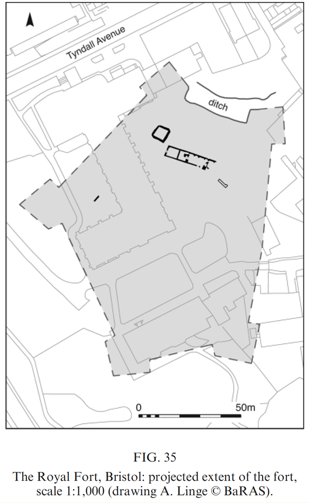
Previous excavations of Royal Fort, Bristol appear to have underestimated its size, for example the BaRAS excavations of 2014 (https://doi.org/10.1179/0079423614Z.00000000047) included the following illustration, which shows the southern end of the fort reaching only as far as the bay window of Royal Fort house. Our excavations, however, seem to be revealing a much larger footprint for the fort itself.
BaRAS unfortunately missed a key resource for understanding the earlier landscape in the area. Namely, Humphrey Repton’s ‘Red Book’ entitled ‘The Fort nr. Bristol, a seat of Thomas Tyndall esq’ in which it shows the shape of the fortification (unfortunately without a scale to gauge its dimensions) as well as other useful information. BaRAS can be forgiven however as the book was located in Yale university library, Connecticut and may not have been digitised at the time.
Repton used a plan of the fort taken from one of 56 etchings of the antiquities of Bristol made by Joseph Skelton who in turn utilised artwork by Hugh O’Neill as inspiration. Hugh O’Neill was an English architectural and antiquarian draughtsman, and his drawings are part of the Braikenridge collection held by Bristol City Museum.
Repton’s Red Book also contains a cross-section pen and ink drawing showing, to the left, The House at the Fort (Royal Fort House), then The Pleasure Ground (with accompanying large hole = the remains of a section of Prince Rupert’s Royal Fort), beyond which is The Park.

What is important in this illustration however are the three tiny lines written beneath: the dotted line shows the original shape of the ground; the zigzag line shows the chasms dug from 15 to 20 feet deep; the shaded line shows the present shape of the ground, as altered and planted. Importantly, each one of these lines represents a phase in the landscape’s history. The first line represents the original shape of the landscape, pre-Civil War. 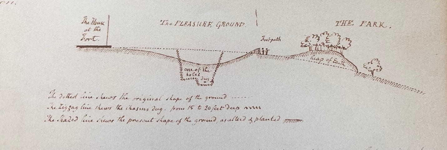 The next line essentially represents the construction of Prince Rupert’s Royal Fort by Bernard de Gommebetween 1643-4 with its vast ditches (which Repton was tasked to fill-in), and the final line represents Humphrey Repton’s relandscaping of the locale into a picturesque pleasure ground.
The image below (Duffy, 1985, 2) shows a cross-section througha typical Civil War fort and this is essentially what we appear to be seeing with our geophysical surveys and excavation on site where we appear to be targeting the most southerly baston of Royal Fort.

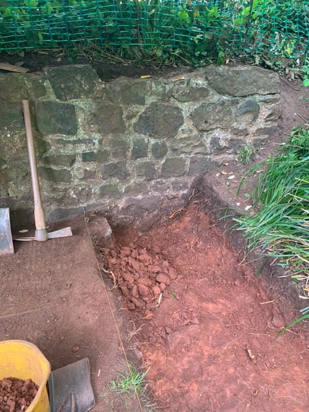
Also, from Repton’s Red Book is the image below, showing a substantial surviving piece of masonry/walling. This wall appears to survive to the present day (despite Repton’s landscaping) and is showing up immediately to the north of our present Trench 3. There is even local folklore suggesting that this is a remaining fragment of the Royal Fort.
 .
. 